The Uninsured Crisis Meets Climate Reality
Southern Africa faces a compounding crisis: climate volatility intensifying alongside catastrophic insurance gaps.
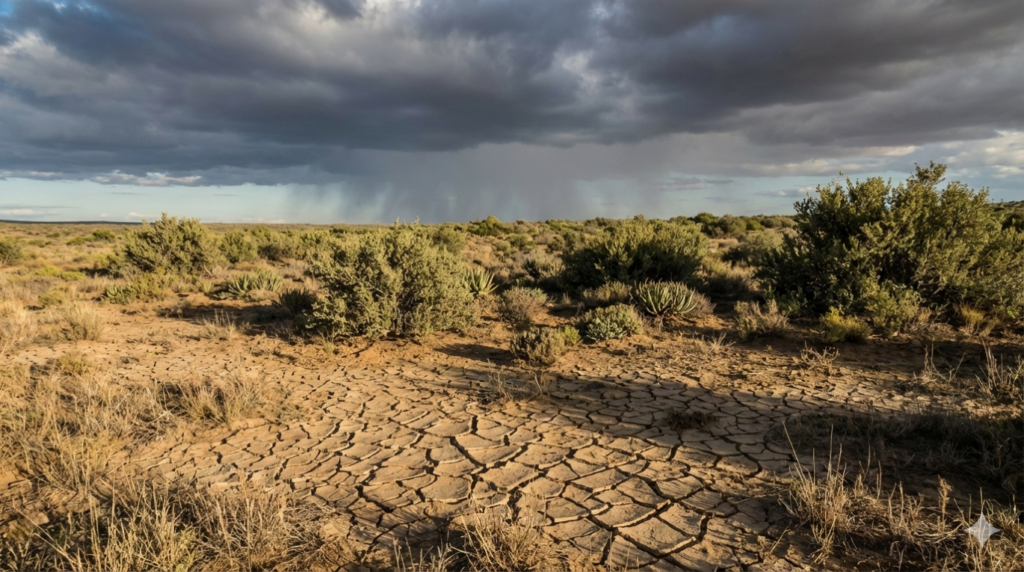
The 2023/24 El Niño delivered the driest February in over a century across the region.
Yet while African Risk Capacity (ARC) demonstrated parametric insurance’s potential—triggering $5.4 million in drought payouts to Mozambique within 72 hours of index confirmation—less than 3% of Southern Africa’s commercial and smallholder farmers hold any agricultural insurance coverage.
Why this gap persists isn’t a lack of need. It’s a failure of data infrastructure at the farm level.
Traditional indemnity insurance requires physical loss assessment. In drought-ravaged rural areas with dispersed smallholders and degraded infrastructure, this process takes 6–8 weeks. By the time payouts arrive, farmers have sold breeding stock, taken predatory loans, or abandoned fields entirely. Parametric insurance—triggered by objective environmental indices rather than loss verification—can compress this timeline to days. But satellite-based parametric products suffer from basis risk: the gap between district-level indices and hyperlocal farm conditions. A farmer on sandy Kalahari soil may lose 40% of his crop, while the satellite-derived district average shows only 12% loss—below the payout threshold. He remains uninsured despite catastrophic damage.
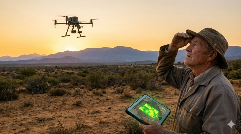
This is the precise gap where drone-collected time-series data can deliver transformative value. And it’s the opportunity Langkloof Agri-Tech is designing to address—not as a drone operator selling flight hours, but as a rural data infrastructure provider enabling financial resilience where it’s needed most.
Why Centimeter-Level Drone Data Can Eliminate Basis Risk
Satellite imagery serves sovereign-scale parametric products admirably. But for commercial agricultural insurance targeting individual farms or cooperatives, resolution limitations create unacceptable basis risk:
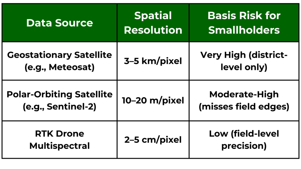
Research demonstrates strong NDVI-biomass correlation in African rangelands—enabling farm-specific trigger calibration that satellite indices cannot achieve. Critically, this relationship varies across biomes, especially in water-stressed Karoo or Kalahari ecosystems where soil-type variations confound satellite signals. Studies confirm that farm-specific NDVI baselines, monitored at weekly intervals during stress events, can significantly reduce basis risk compared to satellite-only triggers.
The technical pathway is proven elsewhere. In Kenya, Apollo Agriculture uses data-driven indices to underwrite parametric credit for smallholders. In Brazil, drone-based vegetation time series now feed directly into parametric crop insurance triggers. The technology stack exists. What’s missing in Southern Africa is a locally grounded operator designing workflows specifically for our dispersed rural landscapes—and intentionally structuring those workflows to create skilled employment, not displace it.
The Employment Multiplier: Designing Technology to Create Rural Jobs
Automation deployed without intentionality risks exacerbating rural unemployment—already exceeding 58% among youth in Eastern Cape districts.
Langkloof Agri-Tech’s founding principle is the opposite: technology should amplify human capability in rural communities, not replace it.
We are designing our operational framework around a 7:1 employment multiplier—seven local jobs created for every drone pilot deployed.
This isn’t theoretical idealism; it’s operational necessity.
A single pilot cannot profitably service dispersed farms across 500km radii without local ground presence. The multiplier emerges from workflow design:

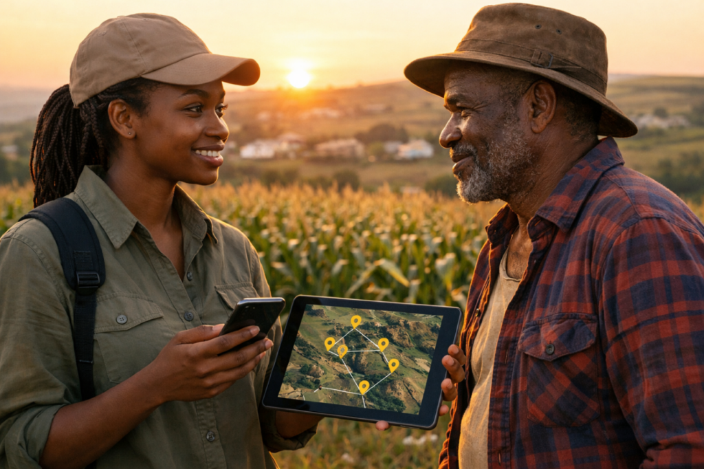
Ground truthers—recruited from villages adjacent to monitored farms—perform critical validation functions that pure automation cannot replicate reliably: verifying AI-detected crop stress against on-ground conditions, marking micro-variations in soil moisture invisible to sensors, and documenting localized hail or pest damage.
This human-in-the-loop layer doesn’t just reduce basis risk; it creates dignified employment with clear upskilling pathways. Workers start at R8,500–R12,000 monthly (above living wage in target districts) with structured progression toward drone pilot certification.
This design aligns with South Africa’s AgriBEE Sector Code requirements for skills development and rural community investment—creating immediate procurement advantages for insurer partners seeking B-BBEE points. It also addresses a critical adoption barrier: farmers trust data validated by neighbors they know, not algorithms operated by distant corporations.
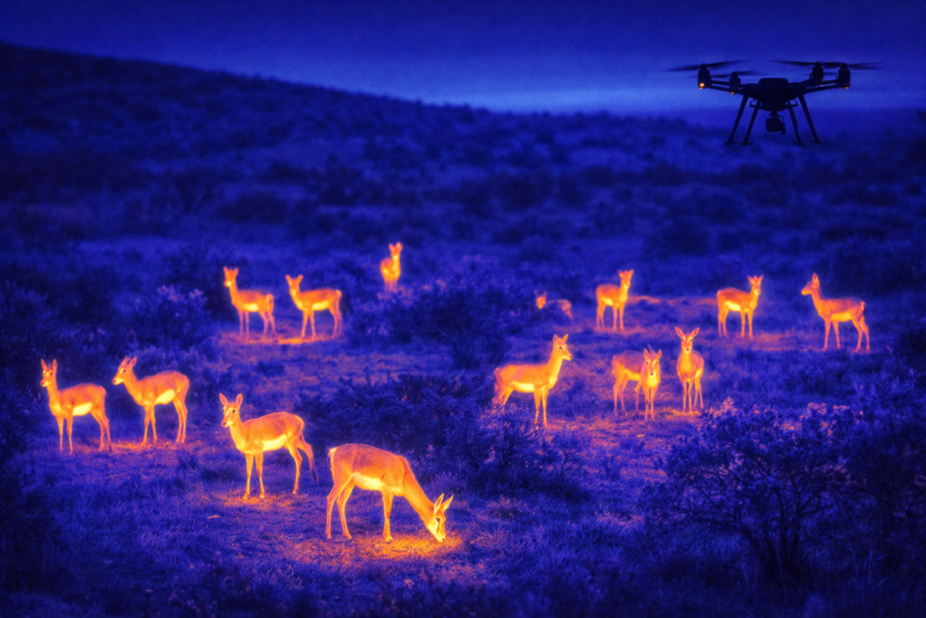
Livestock & Wildlife: The Thermal Imaging Opportunity
Parametric insurance for crops is advancing globally. But livestock—the primary asset for millions of Southern African households—remains largely uninsured.
Satellite imagery cannot detect mortality events until carcasses accumulate.
Thermal drone imaging changes this equation.
Thermal sensors can detect abnormal animal behaviour and body heat signatures in near real-time—even in rugged terrain. This creates a viable parametric trigger based on early behavioural anomalies rather than final carcass counts—transforming insurance from reactive compensation to proactive risk mitigation.
For game farms and commercial livestock operations across LAT’s target footprint (South Africa, Botswana, Namibia, Zimbabwe), this represents a significant addressable market currently underserved by traditional indemnity models.
LAT’s planned deployment of thermal-equipped drones—paired with ground-truthing teams recruited from farm communities—creates both data accuracy and local employment simultaneously.
Why Now? The Convergence Creating Investable Timing
Three converging forces make this the moment to build:
- Regulatory evolution: SACAA is actively evaluating BVLOS (Beyond Visual Line of Sight) frameworks to enable rapid-response agricultural monitoring—a regulatory shift critical for scaling parametric insurance across large rural areas.
- Insurer urgency: Major South African insurers, including Sanlam, have publicly committed to developing parametric products as part of climate adaptation strategies—a shift creating urgent demand for field-level data infrastructure.
- AI readiness: Open-source computer vision models (YOLOv9, Segment Anything) now enable cost-effective analysis of drone imagery without proprietary AI development—dramatically lowering the capital intensity of launch.
LAT is pre-seed and designing its minimum viable deployment specifically to demonstrate this model’s viability to insurers and impact investors. We are not selling flight hours. We are architecting a data pipeline that delivers two outputs simultaneously: (1) insurer-grade trigger data that eliminates basis risk, and (2) skilled rural employment as a core feature—not an afterthought.
The Invitation
The global parametric insurance market is projected to grow from $16B (2024) to nearly $30B by 2030. Yet Southern Africa remains critically underserved at the farm level—not due to lack of technology, but lack of locally grounded operators designing solutions for our specific landscapes and social context.
Langkloof Agri-Tech is building that operator. The pre-seed stage presents the optimal moment for investors who recognize that the highest-margin opportunities in African agritech won’t come from importing Silicon Valley automation models—but from designing technology with rural communities, not for them.
We welcome dialogue with:
°Insurance innovators seeking reliable, farm-level trigger data sources for parametric product development
°AI developers interested in collaborating on Southern Africa-specific spectral libraries (to be built post-funding)
°Impact investors who see rural employment not as a cost center, but as a defensible competitive advantage
The goal isn’t just faster payouts. It’s financial resilience woven into the social fabric of rural Southern Africa—one farm, one dataset, one skilled job at a time.
Johan van Eeden is the founder of Langkloof Agri-Tech (LAT), a pre-seed Drone-as-a-Service platform designing operations across South Africa, Botswana, Namibia, and Zimbabwe. LAT’s mission: deploy conservation technology that creates skilled rural employment while delivering insurer-grade data for parametric agricultural insurance. We are currently engaging early-stage investors aligned with this dual mandate of purpose and profitability.
Contact: johan@latdrones.com
Sources & Further Reading
- African Risk Capacity. (2024). Parametric drought payouts to Mozambique and Malawi. https://www.arc.int
- UNICEF Eastern & Southern Africa. (2025). Response to El Niño. https://www.unicef.org/esa
- Statistics South Africa. (2024). Quarterly Labour Force Survey Q2 2024. https://www.statssa.gov.za/publications/P0211
- Grand View Research. (2024). Parametric Insurance Market Size Report, 2024–2030. https://www.grandviewresearch.com/industry-analysis/parametric-insurance-market
- South African Civil Aviation Authority. Remotely Piloted Aircraft Systems (RPAS) Regulations. https://www.caa.co.za/Regulations/RPAS%20Regulations.pdf